

Field NotesAdventure Storytelling Media
The dam that started to move
A 156-metre arch wall pins a turquoise reservoir into a Valais rock cirque — one that once shifted underfoot.
Ayent, Valais, Switzerland · 2023.08.11
 Aerial work licensed through Amazing Aerial Agency

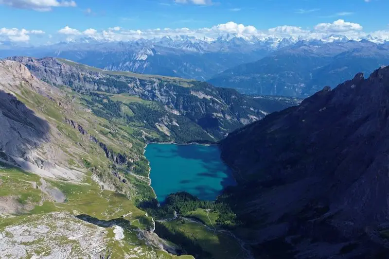
From the air the dam reads first: a thin curve of concrete, 156 metres from crest to base, wedged into a notch in the rock. Behind it the water lies flat and turquoise at 1,777 metres, ringed by grey walls that drop straight into the surface. There is barely a shoreline. The rock goes down, and the colour begins.
The colour is glacial melt — cold water carrying rock flour, held in suspension. The reservoir runs about 140 metres deep and holds some 51 million cubic metres, draining west into the Lienne and down toward the Rhône. East of the basin the ground climbs to the Rawil Pass at 2,427 metres, an old crossing into the Bernese Oberland, with the Wildhorn standing above it at 3,248 metres. From the ridge the snow line of the Valais Alps runs the length of the horizon.
The dam has a stranger history than its stillness suggests. In the late 1970s, engineers boring an exploratory tunnel for a never-built road link between Sion and Bern drilled into water-bearing rock and drained it. The mountain settled, the gorge narrowed by a few centimetres, and the arch began to move. Cracks opened in the concrete. The reservoir was emptied, the tunnel eventually abandoned, and the dam monitored and repaired before it returned to service by 1989.
The way in is a single paved road up the Lienne gorge, threading in and out of tunnels cut into the cliff and ending at the dam crest. Past that it is footpaths — around the water, up to the pass, on toward the Wildhorn. In August the car park holds a handful of cars and the wind comes cold off the lake.